File:2008-08-16 Google satellite view of desert near Gerlach NV.jpg
Jump to navigation
Jump to search

Size of this preview: 800 × 529 pixels. Other resolutions: 320 × 212 pixels | 932 × 616 pixels.
Original file (932 × 616 pixels, file size: 133 KB, MIME type: image/jpeg)
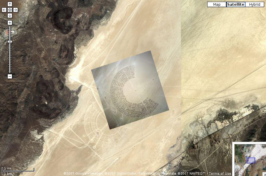
Google Maps satellite view of dried lakebed (playa) near Gerlach, Nevada – overview showing currently active area (looks like a newer photo) plus remains of an older one, or possibly showing an earlier one under construction. ~50 ft per inch close-up of the circular structure in the middle of the C arc is here.
File history
Click on a date/time to view the file as it appeared at that time.
| Date/Time | Thumbnail | Dimensions | User | Comment | |
|---|---|---|---|---|---|
| current | 22:12, 16 August 2007 | | 932 × 616 (133 KB) | Woozle (talk | contribs) | Google Maps satellite view of dried lakebed (playa) near Gerlach, Nevada - overview showing currently active area (looks like a newer photo) plus remains of an older one, or possibly showing an earlier one under construction |
You cannot overwrite this file.
File usage
There are no pages that use this file.