Difference between revisions of "File:2008-08-16 Google satellite view of desert near Gerlach NV - 50ft.jpg"
Jump to navigation
Jump to search
(Google Maps satellite view of dried lakebed (playa) near Gerlach, Nevada -- close-up of "eye" in the middle of the "C" arc) |
|||
| Line 1: | Line 1: | ||
| − | Google Maps satellite view of dried lakebed (playa) near Gerlach, Nevada | + | Google Maps satellite view of dried lakebed (playa) near Gerlach, Nevada – this is a close-up (~50 ft. per inch) of the "eye" in the middle of the "C" arc shown at ~1 mile per inch resolution in [[:Image:2008-08-16 Google satellite view of desert near Gerlach NV.jpg|this image]] |
| + | * Copyright 2007 by Google, Inc.; all rights reserved. | ||
| + | * Reproduced in Issuepedia under [[fair use]] | ||
| + | * Retrieved from [http://maps.google.com/maps?t=k&om=1&ll=40.765724,-119.228316&spn=0.001255,0.002511&z=19 here] on 2007-08-16 | ||
Latest revision as of 22:22, 16 August 2007
Google Maps satellite view of dried lakebed (playa) near Gerlach, Nevada – this is a close-up (~50 ft. per inch) of the "eye" in the middle of the "C" arc shown at ~1 mile per inch resolution in this image
File history
Click on a date/time to view the file as it appeared at that time.
| Date/Time | Thumbnail | Dimensions | User | Comment | |
|---|---|---|---|---|---|
| current | 22:11, 16 August 2007 | 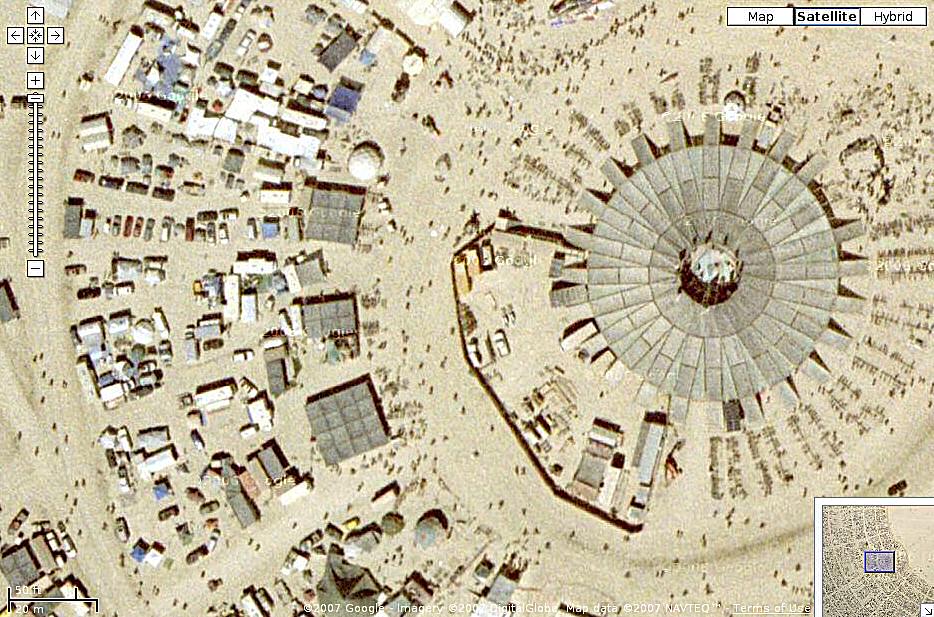 | 934 × 617 (149 KB) | Woozle (talk | contribs) | Google Maps satellite view of dried lakebed (playa) near Gerlach, Nevada -- close-up of "eye" in the middle of the "C" arc |
You cannot overwrite this file.
File usage
There are no pages that use this file.